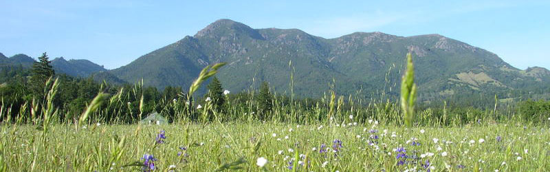
Mt. St. Helena

Calistoga, CA – Robert Louis Stevenson State Park

Last updated on March 7th, 2026 at 12:26 am

Quick Overview:

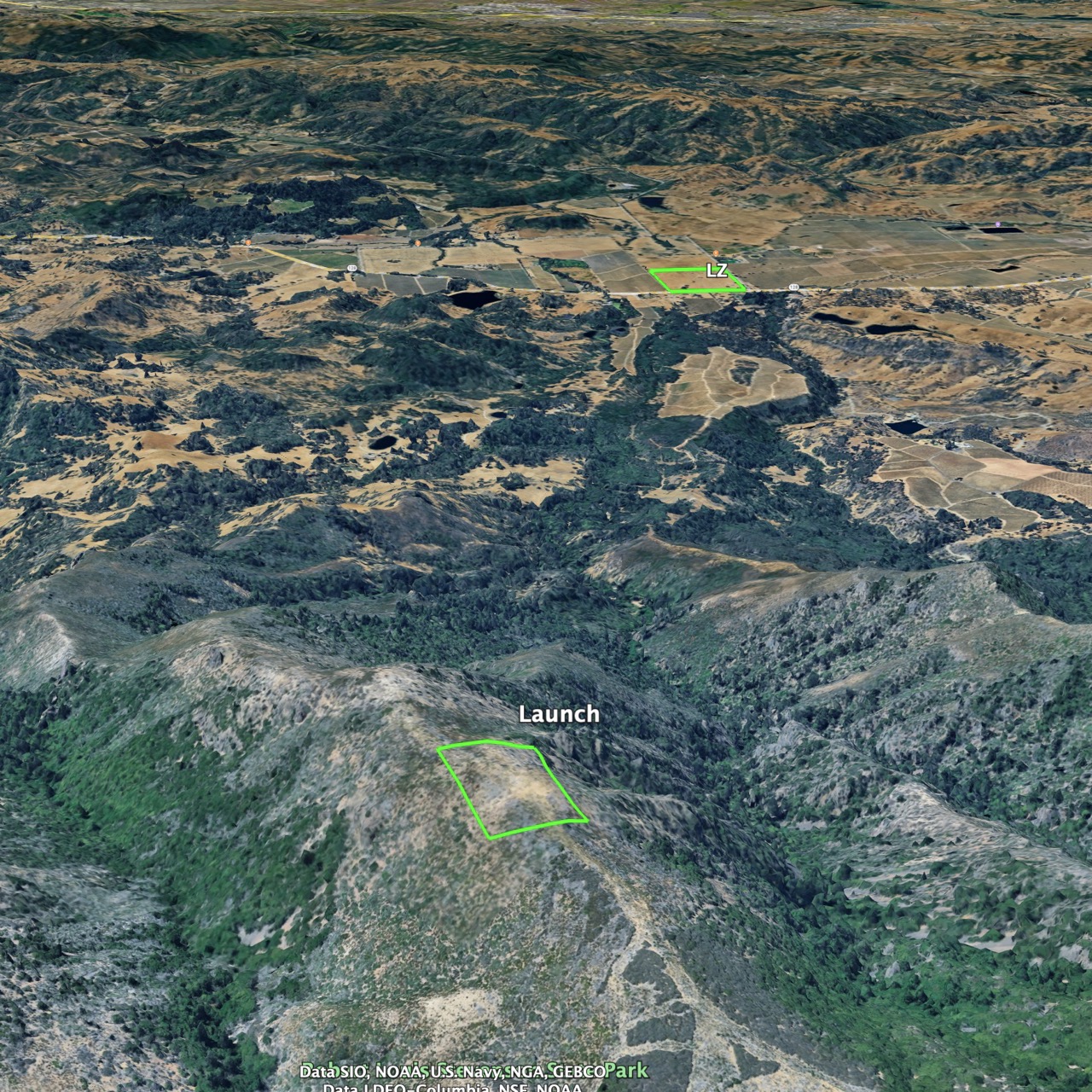
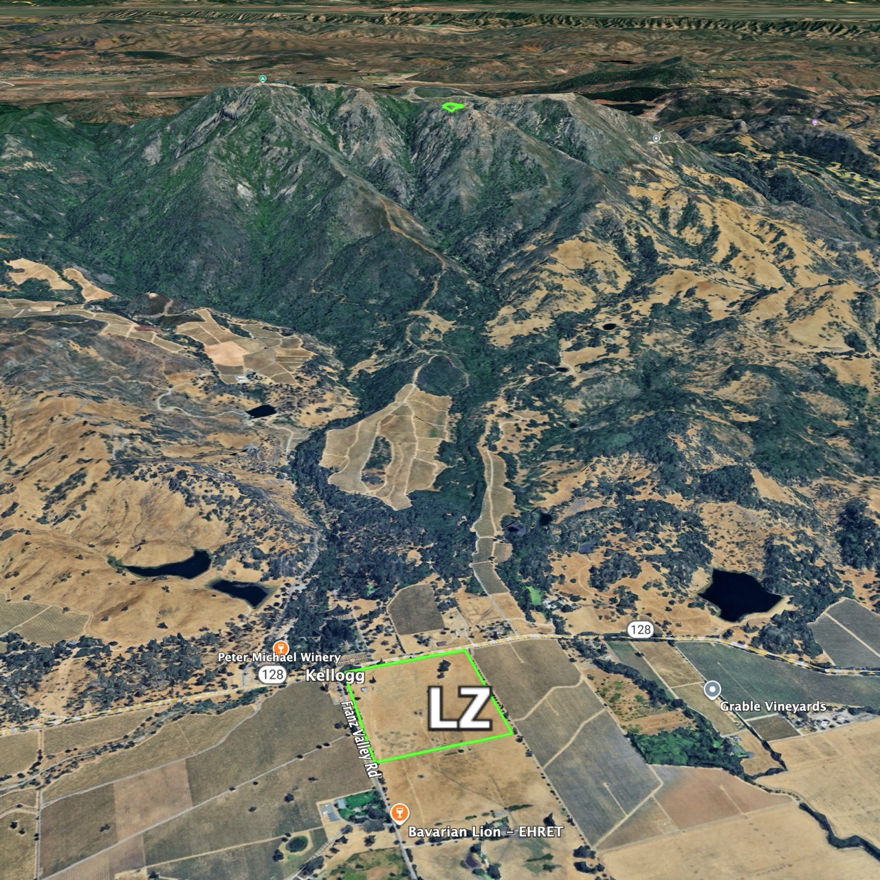
Mt. St. Helena is a peak in the Mayacamas Mountain range located between Napa, Sonoma, and Lake counties that which offers great thermic flying potential.

Telegram Groups

Site Access: Drive or Hike

Radio Frequency: 147.405 MHz

Site Committee Chairs: Eric Beckman & Jon James

[email protected]

Hang gliding: H4 or H3 with sponsor
Paragliding: P4 or P3 with sponsor
Mini-wings: Not allowed

Park Information

Club Rules

  • Current USHPA and WOR (full or visiting) membership
  • Follow all park rules and regulations
  • Follow all FAR part 103 operating requirements
  • Fly with a helmet and an emergency parachute
  • Meet all rating requirements
  • Launch only from a designed launch
  • Land only in a designated LZ unless top landing
  • Call 911 in case of an emergency
  • No commercial activity
  • Report any accidents, incidents or concerns using this form
  • It is recommended to fly with a cell phone, radio and satellite tracker

Site Requirements

  • Leave message to inform park rangers at (707)942-4575 at least 24 hours before going up the mountain
  • Request gate code from site chair AFTER having informed rangers
  • Use is limited to four vehicles and 12 pilots at a time
  • All streamers, windsocks etc. must be removed at the end of each day
  • There are few safe places to land on the way out to the LZ, so don’t get low on the mountain
  • Speed wings are not allowed

Launch

Middle Spine Launch is at 3,800′

Wings: NW-SW

HG & PG: 0-14mph, ideal 6mph, gust 5 mph

Glide ratio: 6:1

Landing Zone (LZ)

  • Large field in Knights Valley, privately owned
  • We are VERY lucky to be able to use this field – everywhere else is vineyards
  • Gate is usually locked – do NOT climb OVER gates or fences
  • Conditions are usually light winds out of the W or NW
  • Spring winds can sometimes be strong and turbulent, especially on the ground
  • Watch out for wires and turbulence from trees.

Weather Information

  • In summer the marine airmass from the south  usually dominates, so soaring conditions are poor
  • Best times are spring and sometimes in the fall
  • 5,000 – 6,000 ft MSL is typical over the mountain, 7000’+ is good
  • Thermals can be rough over the big rocks at the North Peak
  • Early in the year, the valley and LZ can be very good and smoother than the top

Vehicle Access

  • There is a locked gate on the road to launch – request code from site chairs after informing rangers of planned flight
  • Drivers must exercise extreme caution while driving on park roads due to hikers. Do not exceed 15 mph and go slow when passing hikers. Drive so as to create a minimum of dust. We want no complaints about this
  • Vehicles must stay on designated roads. They are not allowed on the road to the North Peak
  • Drivers must ensure that the gate is locked when leaving the park