Mt. Diablo
Walnut Creek, CA – California State Parks
Last updated on April 15th, 2026 at 12:46 pm
Walnut Creek, CA – California State Parks
Last updated on April 15th, 2026 at 12:46 pm
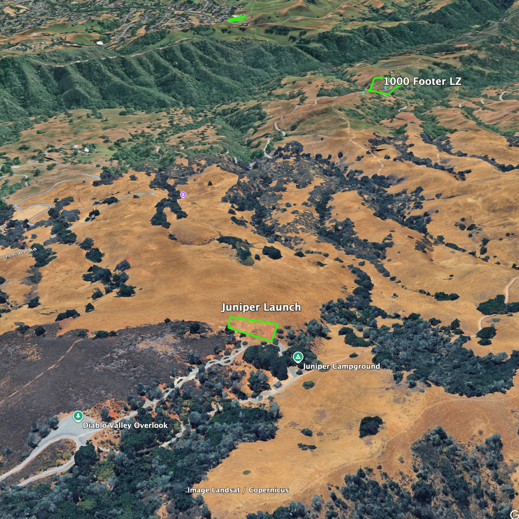
Mt. Diablo offers an excellent variety of soaring experiences to the advanced pilot. Pilots regularly soar Diablo’s shear rocky peaks, rolling hills and ridges, gnarly canyons and grassy pastures; sometimes all in the same flight.

Winds: SW-W
HG:0-25mph, ideal 7mph, gust 8mph
PG: 0-20mph, ideal 5mph, gust 7mph
Glide ratio: 4:1
Environmental concern:
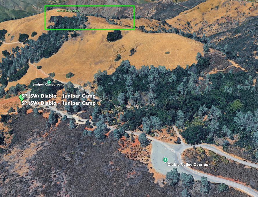
Winds: W-NE
HG:0-15mph, ideal 7mph, gust 8mph
PG: 0-15mph, ideal 5mph, gust 7mph
Glide ratio: 5:1
Environmental concern:
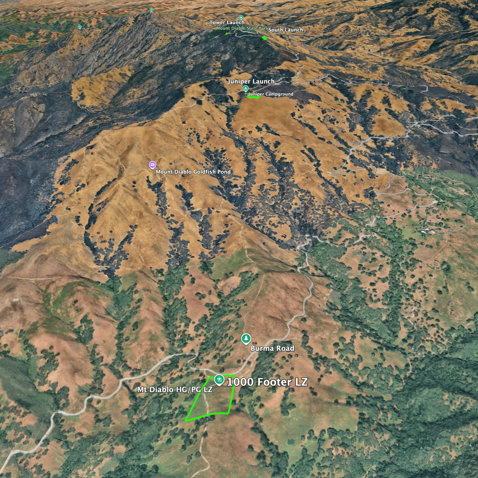
Winds: ESE-S
HG & PG: 0-12mph, ideal 7mph, gust 5mpg
Glide ratio: 5:1

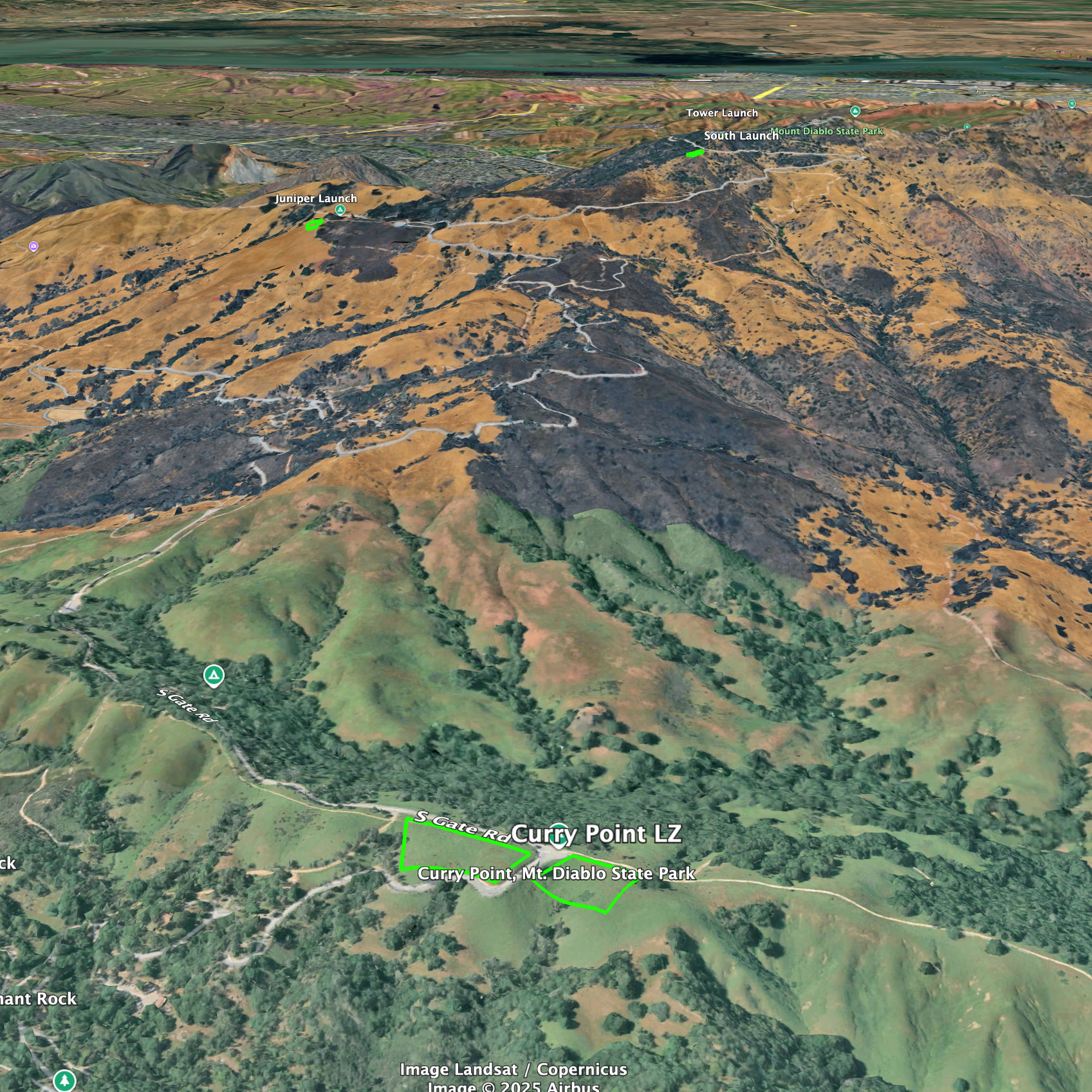
Winds: NW-NE
HG & PG: 0-10mph, ideal 5mph, gust 5mph
Glide ratio: 5:1
Environmental concern:

Paragliding
Hang gliding

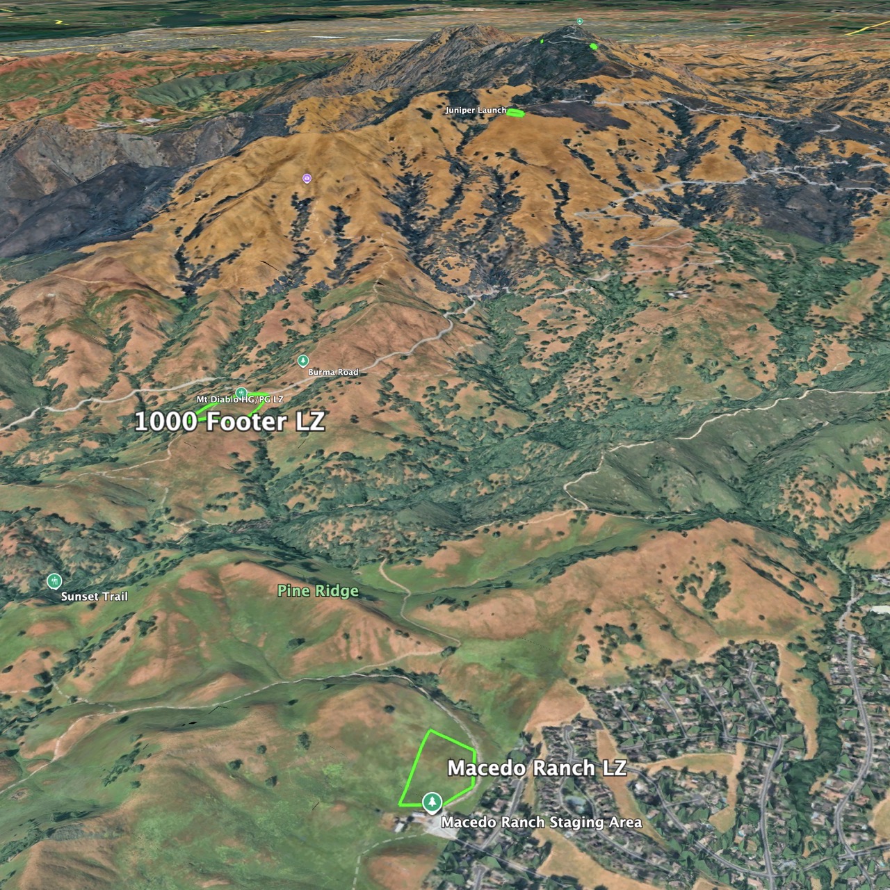
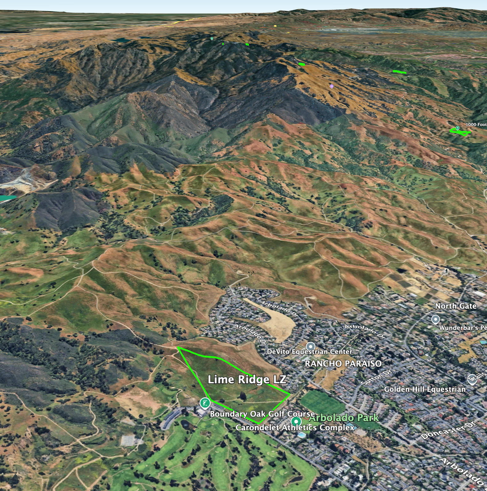
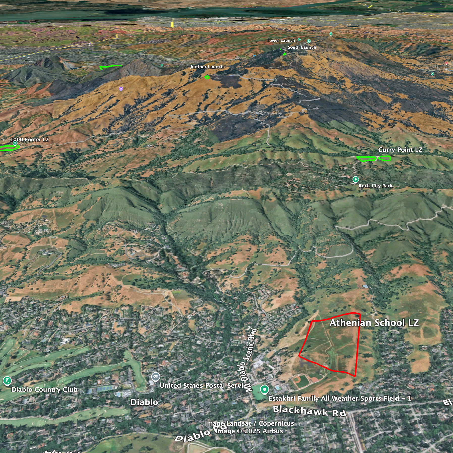
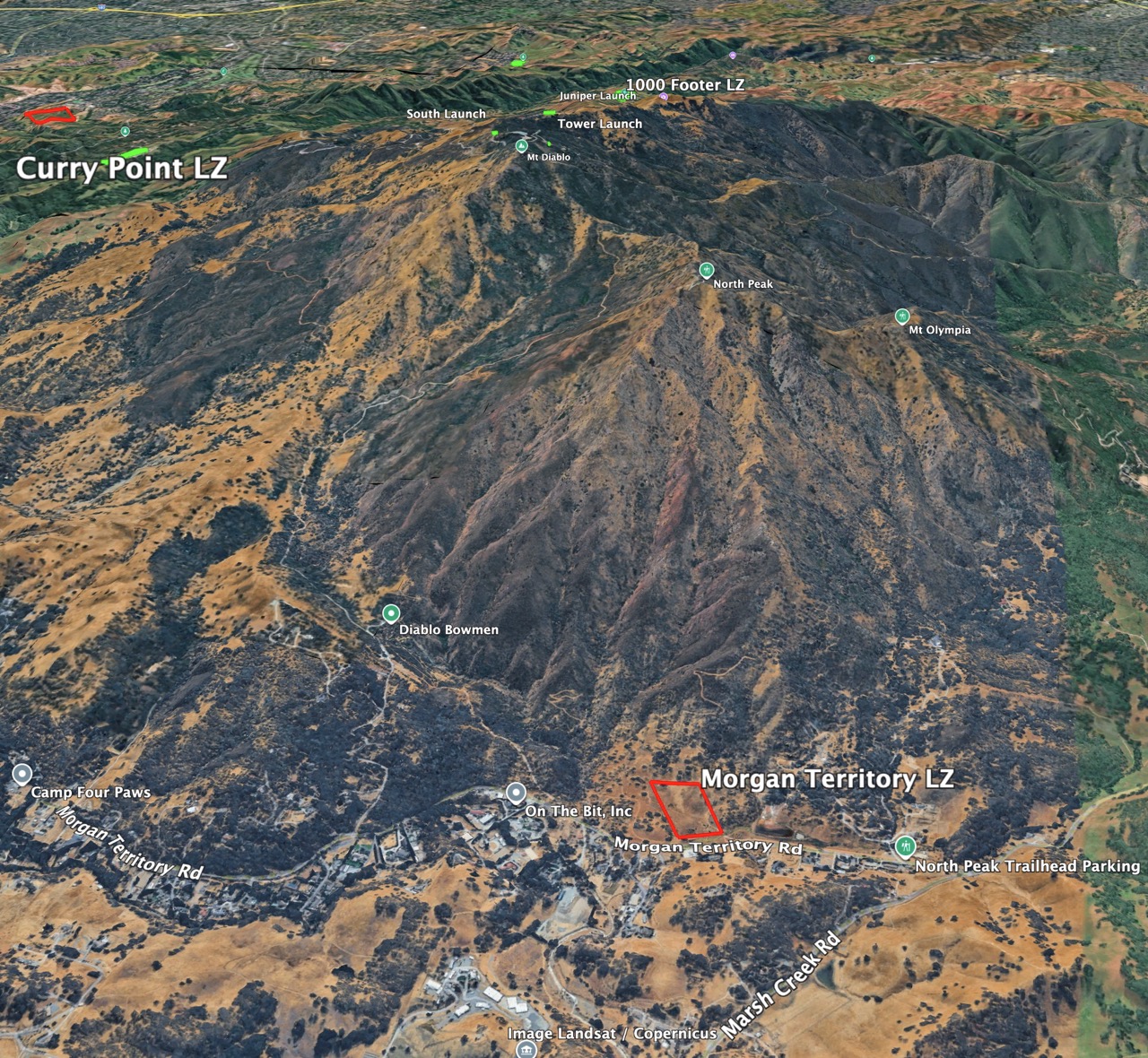
Depending on the combinations of launch, LZ and weather conditions, Mt. Diablo can offer simple or challenging flights. Consult an experienced Diablo pilot for details on soaring conditions.